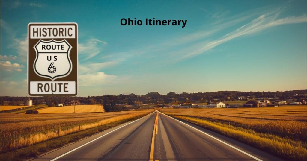
Ohio Itinerary
Starting from the west – Williams County has the quaint village of Edgerton in northeast Ohio where this village began due to the needs of the railroad. Similar to Chicago, the “Blaze of 1893” was a huge fire of the downtown area that the local fire brigade could not extinguish. Therefore, the only “original” storefront is at the local Barber Shop.
Rita’s Family Diner at the corner of Route 6 and Michigan Ave. in Edgerton, Ohio is an excellent “Family restaurant” which I would recommend.
Traveling east on Route 6 will keep you south of the County Seat, which is Bryan Ohio, but it is worth the trip because you are so close to the world famous Dum Dum Sucker Water Tower. Spangler Candy World is the factory that produces the Dum Dum’s and they have the water tower to prove it. It is quite the sight! Plan on a “sit tour” in the big screen theater and it will make the whole trip worthwhile.
Stoney Ridge Winery slightly farther north of Bryan, Ohio on County Road 15 then northeast on U.S. Route 127. Taste the wines but check the restaurant hours by making a phone call before you go.
Henry County
Henry County was named after Patrick Henry, a Revolutionary War patriot. The County site, Napoleon, is right on Historic Route 6 and has many interesting shops, eateries, and just about anything you might need. The “found in Ohio” information site is a part of the Henry County website and I have added it to this post. Go to https://foundinohio.com/category/henry-county/ for more information but do not forget to drive by the Campbell’s Soup Factory about a mile off Route 6. Campbell’s has had a presence in Ohio since 1938 when it started making V8 in Napoleon Ohio, that factory is one of three site in the U.S.
Sandusky County
Sandusky County is the home of the Rutherford B. Hayes Presidential Library & Museum in the city of Fremont. Historic Route 6 was the main street through downtown Fremont until the “bypass” was put in which takes Route 6 around the city of Fremont. For those who choose to “stay on the OLD Route” through Fremont will see a small city at work. There are lots of opportunities to shop and eat in the downtown area. The Presidential Museum is slightly northwest of downtown in Spiegel Grove. It was the first Presidential Library, built in 1916, and remains the estate of President Hayes, the 19th President of the United States.
In Gibsonburg Ohio, slightly north of Route 6 is Williams Park. The park has numerous memorial sites for various conflicts where lives were lost. From the Twin Towers to other conflicts and various other memorials the walk is an interesting and moving remembrance. While in town there are other activities as well. Maybe Lagoon Deer Park is what you are wanting to visit. For more information check out Sandusky County Community Video Tour .
Erie County
As you come into Erie County from the west, you will find a plethora of things to do as you approach the city of Sandusky. Yes, there is a county and a city named Sandusky, but the city is not in that county. For activities, you will find private tours, theme parks, day trips, water parks, outdoor parks, specialty museums, great places to eat, and much more. TripAdvisor does a great job of highlighting this information so you can track it down there.
Aside from the water parks and theme parks, the Merry-Go-Round Museum in downtown Sandusky is well worth a visit. You are only blocks from Lake Erie, which offers fishing, boating, parasailing, and more. The Maritime Museum also provides excellent history and Lake Erie–focused adventures to explore.
From Sandusky to Vermilion to Lorain, the ride on Historic Route 6 is a trip of beauty and enjoyment. Driving right by Cedar Point’s main entrance may entice you to “come on in,” or the Woolly Bear in Vermilion may encourage you to stop and explore the historic Captain’s Homes, now operating as B&Bs.
This part of Historic Route 6 is also known as the Lake Erie Coastal Trail. The Coastal Trail circles the lake, so as you cross state lines different routes may pick up the scenic drive, but from Sandusky to Cleveland that trail follows Historic Route 6.
Lorain is home to the Charlie Berry Bridge. Erie Avenue, which is Historic Route 6, was built in the 1930s and is the largest bascule bridge in the world. Although it was stuck in the open position for a time last year, the traffic that crosses the bridge—and therefore Route 6—is enormous, as it is the main thoroughfare through town.
Cuyahoga County
From Erie County into Cuyahoga County, the beautiful drive along Lake Erie continues. The many lake views may slow your trip, but the experience is well worth it. From sticking your toes in the water to searching for beach glass, the time you spend along the lake is memorable.
As you cross the Cuyahoga River, Historic Route 6 offers a choice between the newer Lake Erie Coastal Trail route or the original route along Detroit Avenue, both of which provide great and unique places to stop. From the aquarium to the West Side Market, the time you spend here is well spent.
In downtown Cleveland, Route 6 follows Superior Avenue, taking you right through the heart of the city. The Soldiers’ and Sailors’ Monument, the Arcade, the Cleveland Public Library, and the theater district are all sights to take in. Whether walking or driving Superior Avenue, it is worth detouring to see the stadiums downtown, the Federal Reserve Bank and its Superman display, and, of course, the Rock & Roll Hall of Fame.
Lastly, the Theater District—ranked just behind New York City’s—may entice you to stay and catch a show. Right behind the district is the Hofbräuhaus, a popular German eatery.
As you leave Cuyahoga County heading east, be sure to include stops at the Art Museum, the Children’s Museum, the Museum of Illusions, the house from A Christmas Story, the USS Cod Submarine Memorial, the Natural History Museum, the Great Lakes Science Center, the Baseball Heritage Museum, and others. You will also be close to Lake View Cemetery, which is well worth a tour, featuring famous graves, the Garfield Memorial, Millionaires’ Row, and more.
Geauga County
As you enter Geauga County from the west, Route 6 climbs a fairly steep knoll, taking you past St. Denis Golf Course. There are five golf courses in the area for those interested in stopping to play. This climb also helps explain why Chardon sits at the second-highest elevation in Ohio. With Lake Erie only a few miles to the north, the elevation contributes to Chardon’s reputation as the Snow Capital of the state.
The Chardon Circle marks Historic Route 6 as it travels east and west through the county seat. The circle is surrounded by local shops, restaurants, and points of interest that reflect the character of the community. The name “Geauga” comes from a Native American word meaning “raccoon” (Sheauga), originally referring to the Grand River. Early settlement began in Burton around 1798, and Chardon became the county seat in 1812.
Geauga County’s history includes significant Amish settlement, the nation’s oldest state fair—the Great Geauga County Fair, established in 1823—and early tourism dating back to the 1830s, when visitors were drawn to Little Mountain’s reputed healing springs. Today, the county is widely known for its Amish culture, maple syrup production, and strong rural heritage.
The Geauga Parks District maintains numerous parks throughout the county. Observatory Park in Montville Township stands out as the sixth-darkest certified Dark Sky Park in the United States. Visitors are encouraged to check the park district’s website for current programs and activities. Traveling south toward Burton or Middlefield brings you into a large Amish population, with many family-owned “mom and pop” shops scattered throughout the countryside.
Ashtabula County
Leaving Geauga County and entering Ashtabula County, you will encounter Ireland Road, which runs south from Route 6. Ireland Road is home to the world’s tallest statue of Our Lady of Guadalupe. Located in Windsor, Ohio, the statue stands 33 feet tall at the center of a 50-acre farm. Inspired by Pat and “Deacon Ed” Heinz, it is covered with more than 450,000 mosaic tiles. The design and construction were donated by Richard Hyslin of Mission, Texas, along with his students and volunteers, who spent over 10,000 hours creating this remarkable work of art. It holds the World Record Academy title for the World’s Tallest Our Lady of Guadalupe and is well worth the side trip.
While in Ashtabula County, visitors may want to explore the local wineries. The Ashtabula Wine District, centered in Northeast Ohio’s Grand River Valley, developed from fertile glacial soils ideal for grape growing. By the late 20th century, it became Ohio’s largest grape-producing region, particularly known for Welch’s Concord grapes. Today, the area is a diverse wine destination with more than two dozen wineries, benefiting from Lake Erie’s moderating climate and evolving beyond juice grapes into a wide range of wine styles.
The region’s well-drained, glacier-deposited soils combined with Lake Erie’s influence—cooler summers and delayed frosts—create excellent conditions for viticulture. The name “Ashtabula” comes from an Iroquois word meaning “river of many fish,” reflecting the area’s natural abundance. A drive north to Lake Erie can easily include a day of fishing.
Along Route 6, you will cross Route 45, a roadway tied to the history of the Underground Railroad in the 1800s. A gazebo at the intersection marks the site of an original school building where escaping enslaved people reportedly hid as they made their way north. More information about this history is available by contacting ghunterrometownship@gmail.com.
Returning to the wineries, the only one located this far south at present is found on Loveland Road, south of Historic Route 6 in Cherry Valley Township. Emerine Winery, also in Cherry Valley Township, is a unique and worthwhile stop.
As you leave Cherry Valley Township and enter Andover Township, you will pass one of the largest Amish furniture stores in the area. Even a brief visit is worthwhile to explore the craftsmanship on display.
Andover and the Route 6 Detour
Andover Village is where Route 6 departs its traditional east–west alignment and travels approximately 7.5 miles north before entering Pennsylvania. The reason for this shift is part of the highway’s history. In the 1920s and early 1930s, Route 6 was known as State Route 85 and ran directly east out of Ohio.
When Ohio and Pennsylvania were finalizing their highway connection in the early 1930s, construction of the Pymatuning Lake dam was underway. The Civilian Conservation Corps played a key role in developing what is now a beautiful state park area. As a result, about 2.5 miles of State Route 85 remain in Ohio, while Historic Route 6 curves north before crossing into Pennsylvania. One long-standing theory suggests the route was shifted simply “to stay on solid ground.”
Subscribers often say that Happenings feels less like a newsletter and more like a friendly guide riding along in the passenger seat. It keeps you informed about new attractions, museum updates, special events, and preservation efforts that keep the spirit of Route 6 alive. The early access itineraries are just one of the many ways the newsletter helps you travel smarter and discover more along the road. By subscribing, you gain exclusive insights into hidden gems and carefully curated routes that enhance your exploration of this historic corridor. Each itinerary is designed to provide not only practical information but also rich narratives that connect you to the culture and history of the regions you’ll encounter.
Start Your Route 6 Journey Today If you love historic highways, small-town discoveries, and authentic travel experiences, this is your invitation. Subscribe to Happenings and be among the first to receive insider itineraries that transform a simple drive into a memorable journey across America’s heritage highway. Your next great road trip could be waiting in the very next issue. Subscribe today and let Route 6 come to you, one story at a time.
Subscribe today and let Route 6 come to you, one story at a time.