Was Rosamond California served by historic US Route 6
Short answer: Yes — for a period, Rosamond was on or adjacent to the route of historic U.S. 6 (via its alignment along Sierra Highway), although today U.S. 6 no longer reaches that far south. What follows is a tour through highway history, local geography, and the legacy that still lingers in Rosamond’s roadways.
Introduction: The legend of U.S. 6 and the roads it left behind
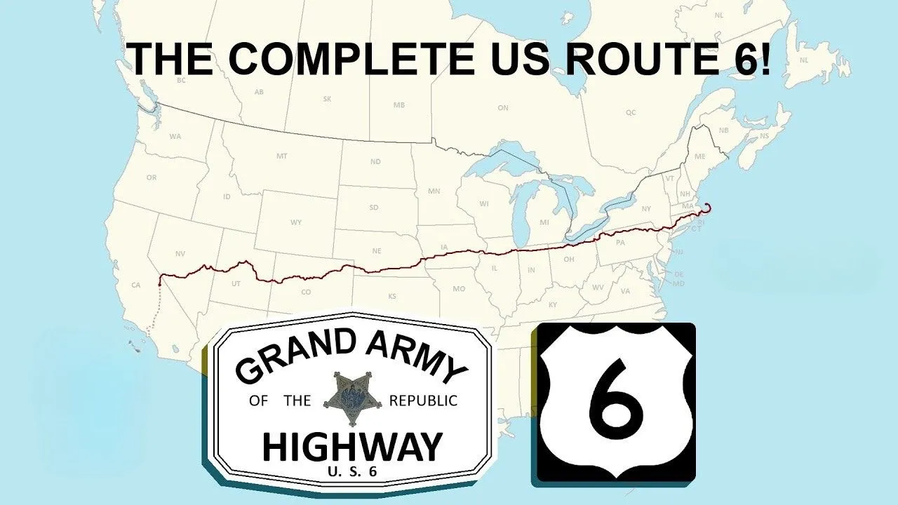
In the heyday of the U.S. numbered highway system, U.S. Route 6 (also known as the Grand Army of the Republic Highway) was among the most ambitious — stretching from the Pacific to the Atlantic, it once claimed the title of the longest U.S. highway. Wikipedia
Over time, as interstate highways and state-level renumbering reshaped travel arteries, U.S. 6’s routing was truncated and reconfigured, especially in California. SoCal Region But in its earlier incarnations, U.S. 6’s shadow still touched communities like Rosamond through the old alignments of Sierra Highway (also known as El Camino Sierra).
To appreciate Rosamond’s place in this story, one must understand both the geography of that High Desert corridor and the evolution of Sierra Highway itself.
Geographical and local context: Rosamond and the High Desert corridor
Rosamond sits in northern Kern County, in the Mojave Desert’s High Desert zone, just north of Lancaster and Palmdale in the Antelope Valley. Wikipedia Its elevation is around 2,500 feet (roughly 767 meters) and the town grew as a desert outpost tied to mining, cattle, and later aerospace via Edwards Air Force Base. Wikipedia
Today, the main north–south artery through Rosamond is State Route 14 (the Antelope Valley Freeway) — this route carries modern traffic between Greater Los Angeles and the desert north. SoCal Regionnia Highways But paralleling or overlapping older roadways is Sierra Highway — the historic alignment that once carried U.S. 6 in this region.
Sierra Highway (also known as El Camino Sierra) is a road of deep roots. It predates many of the numbered highways; the route had been used as an auto/travel corridor in the early 20th century, connecting Los Angeles side toward the Eastern Sierra and onward. Wikipedia In its later form, sections of Sierra Highway carried U.S. 6 before the 1964 renumbering in California. AARoads Wiki
Within Rosamond itself, there is still a “Sierra Hwy” roadway (or neighborhood) recognized locally. nextdoor.com That alignment hints at the footprint of the old route in town.
Historical routing of U.S. 6 in California and Rosamond’s connection
U.S. 6 in California: extension, truncation, and legacy
When first extended into California in the 1930s, U.S. 6 ran from the east (Colorado) through Nevada into eastern California, then continued southward via combinations of roadways, eventually reaching Long Beach, California. Route 6 Tour During that era, the route used segments of Sierra Highway and other local roads to bridge the gaps. SoCal Region California Highways
However, in 1964, California undertook a major renumbering of its highways, and all of U.S. 6 south of Bishop was decommissioned in terms of federal signage — effectively retracting the highway to the eastern Sierra region. Route 6 Tour AARoads Wiki The southern segments that had carried U.S. 6 were converted to state or local routes — for example, parts became State Route 14 (or older alignments of it) and parts were relinquished. Route 6 Tour Wikipedia In more recent years, in 2007, the state legislature recognized parts of the decommissioned route as Historic U.S. 6 and allowed markers to be placed along the old alignments. Route 6 Tour Wikipedia
As of today, the active U.S. 6 in California is a relatively short 40.5-mile segment running from Bishop northward toward the Nevada state line. Wikipedia The southern stretches are no longer part of the federal U.S. 6 network. AARoads Wiki
Rosamond: Was it “on” U.S. 6?
Evidence suggests that Rosamond was indeed on or adjacent to the historical alignment of U.S. 6 as it passed through the Mojave/Antelope Valley corridor using Sierra Highway. For instance:
- A webpage titled “US 6 – Rosamond” identifies Rosamond as the first town on U.S. 6 in Kern County. SoCal Region
- Archived photos purportedly show “U.S. 6 highway in Rosamond, California, in 1954.” Facebook
- Highway historians note that north of Rosamond, the surface Sierra Highway (former U.S. 6) merges into the Route 14 expressway north of Silver Queen Road. California Highways
- In the California Highways documentation, mention is made that U.S. 6 was never signed along the freeway version of Route 14, but the surface road version (Sierra Highway) carried its alignment in that corridor. California Highways
So while U.S. 6 no longer serves Rosamond, in the mid-20th century its presence was felt through the Sierra Highway route that passed through or nearby.
In more practical terms, the old alignment would have run along what is now Sierra Highway through Rosamond, before that roadway was bypassed or supplanted by the modern SR 14 freeway. Over time, many travelers simply shifted to the newer, faster routes, but the older road remains as a kind of ghost imprint of U.S. 6 in that region.
Landmarks, stories, and traces in Rosamond
While Rosamond may not have massive monuments to U.S. 6 as some towns along the active segment do, there are small but telling connections:
- The very existence of Sierra Hwy within Rosamond — still named and functioning as a road segment — is a living heir to the old U.S. 6 alignment through the Mojave corridor. nextdoor.com
- That “US 6 – Rosamond” webpage (mentioned earlier) implies cross streets and photos exist showing the highway in town, especially in the mid-1950s. SoCal Region
- The road configuration north of Rosamond provides a clue: the old Sierra Highway merges into the SR 14 expressway near Silver Queen Road, aligning with where U.S. 6’s old path would have transitioned to the freeway. California Highways
- The town’s growth in the postwar era would have brought traffic through those roads — travelers heading to desert destinations, mining outposts, or exploring the Owens Valley—and Reno/Denver bound motorists would have passed through that high desert corridor. The presence of U.S. 6 signage, gas stations, and motels along Sierra Highway in Rosamond would have been part of that mid-century road culture.
These are small clues, but they point to a shared history: Rosamond was along the path that U.S. 6 once took before the modern highways reshaped travel.
Why U.S. 6 no longer serves Rosamond — and why that matters
Why did U.S. 6 retreat from places like Rosamond? Two main forces:
- 1964 highway renumbering in California: California undertook a sweeping rationalization of its highway system. Many U.S. highways (especially those duplicating state highways or local roads) were removed or truncated. U.S. 6 was one of those — all of its route south of Bishop lost federal signage and status. Route 6 Tour AARoads Wiki
- Construction of faster highways and freeway bypasses: As travel demand grew, freeways and expressways (like SR 14) offered higher speed, larger capacity, and more direct routes. The older surface alignments (e.g. Sierra Highway) often became frontage roads, bypassed segments, or were relinquished to local control. SoCal Region
That said, the legacy of U.S. 6 still matters. In 2007, the state formally allowed Historic U.S. 6 signage to be placed on former alignments, preserving memory even where the route has been erased from maps. AARoads Wiki For communities like Rosamond, those old alignments are more than curiosities — they are threads connecting modern life with the era when cross-country road travel was central to American identity.
In Rosamond’s case, the surviving segments of Sierra Highway, the old “US 6 in Rosamond” photos, and the knowledge that motorists passed through the town on that historic route give the place a tangible connection to the broader story of U.S. highways.
Conclusion: The value of remembering
Yes — Rosamond once lay in the path of historic U.S. 6, via Sierra Highway. Over time, the federal designation was removed and travel patterns shifted, but echoes of that era remain in road names, local memory, and the faint traces of old alignments.
For the enthusiast traveler, driving along Sierra Highway through Rosamond is more than a shortcut — it’s a way to feel the pulse of mid-century road travel, to imagine the stream of cross-country travelers, and to see how communities adapted when modern freeways arrived.
U.S. 6 today no longer reaches Rosamond, but for a time it did — and its imprint remains. If you ever journey through the High Desert, take a detour along Sierra Highway through Rosamond. Listen for the ghosts of travelers who once drove America’s grand highway across the desert.